

Carte topographique Salem
Cliquez sur la carte pour afficher l’altitude.
Salem
Salem is located at 11°40′N 78°08′E / 11.67°N 78.14°E / 11.67; 78.14, at an average elevation of 278 m (912 ft.). The city is surrounded by hills: Nagaramalai on the north, Jarugumalai on the south, Kanjamalai on the west, Godumalai on the east and the Shevaroy Hills on the northeast. Kariyaperumal Hill is in southwestern Salem. The Thirumanimutharu River flows through the city, dividing it in two. The fort area is the oldest part of Salem.
À propos de cette carte
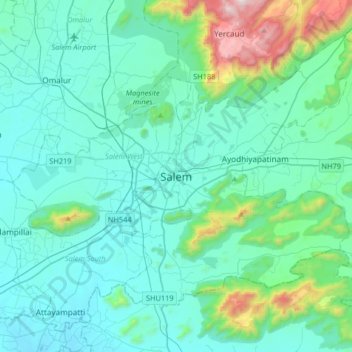
Nom : Carte topographique Salem, altitude, relief.
Lieu : Salem, Salem District, Tamil Nadu, 636001, India (11.50120 78.00025 11.82120 78.32025)
Altitude moyenne : 429 m
Altitude minimum : 218 m
Altitude maximum : 1 626 m