
Carte topographique Neuenwalde
Carte interactive
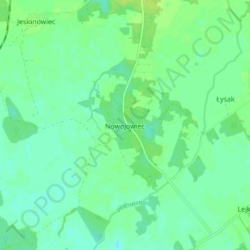
Cliquez sur la carte pour afficher l’altitude.
À propos de cette carte
Nom : Carte topographique Neuenwalde, altitude, relief.
Altitude moyenne : 129 m
Altitude minimum : 123 m
Altitude maximum : 135 m
Autres cartes topographiques
Cliquez sur une carte pour visualiser sa topographie, son altitude et son relief.
Kallenau
Polen > Woiwodschaft Ermland-Masuren > powiat szczycieński
Kallenau, Gemeinde Mensguth, powiat szczycieński, Woiwodschaft Ermland-Masuren, 12-120, Polen
Altitude moyenne : 156 m
Wacholderau
Polen > Woiwodschaft Ermland-Masuren > powiat szczycieński
Wacholderau, gmina Wielbark, powiat szczycieński, Woiwodschaft Ermland-Masuren, 12-160, Polen
Altitude moyenne : 124 m
Ingelheim
Polen > Woiwodschaft Ermland-Masuren > powiat szczycieński > Kallenczin
Ingelheim, Kallenczin, gmina Dźwierzuty, powiat szczycieński, Woiwodschaft Ermland-Masuren, 12-120, Polen
Altitude moyenne : 159 m
Wilhelmsthal
Polen > Woiwodschaft Ermland-Masuren > powiat szczycieński
Wilhelmsthal, gmina Szczytno, powiat szczycieński, Woiwodschaft Ermland-Masuren, 12-100, Polen
Altitude moyenne : 136 m