

Carte topographique Mathews
Cliquez sur la carte pour afficher l’altitude.
À propos de cette carte

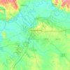
Nom : Carte topographique Mathews, altitude, relief.
Lieu : Mathews, Montgomery County, Alabama, 36029, United States (32.24542 -86.02385 32.28542 -85.98385)
Altitude moyenne : 77 m
Altitude minimum : 65 m
Altitude maximum : 101 m
Autres cartes topographiques
Cliquez sur une carte pour visualiser sa topographie, son altitude et son relief.
Montgomery
United States > Alabama > Montgomery County
Montgomery is located at 32°21′42″N 86°16′45″W / 32.36167°N 86.27917°W / 32.36167; -86.27917. According to the U.S. Census Bureau, the city has a total area of 156.2 square miles (405 km2), of which 155.4 square miles (402 km2) is land and 0.8 square miles (2.1 km2) (0.52%) is water. The…
Altitude moyenne : 66 m


Woodmere Park
United States > Alabama > Montgomery County > Montgomery > Bellwood Plantation
Altitude moyenne : 84 m
Montgomery
United States > Alabama > Montgomery County
According to the United States Census Bureau, the city has a total area of 162.27 square miles (420.3 km2), of which 159.86 square miles (414.0 km2) is land and 2.41 square miles (6.2 km2) (0.52%) is water. The city is built over rolling terrain at an elevation of about 220 feet (67 m) above sea level.
Altitude moyenne : 66 m
Montgomery
United States > Alabama > Montgomery County
According to the United States Census Bureau, the city has a total area of 162.27 square miles (420.3 km2), of which 159.86 square miles (414.0 km2) is land and 2.41 square miles (6.2 km2) (0.52%) is water. The city is built over rolling terrain at an elevation of about 220 feet (67 m) above sea level.
Altitude moyenne : 65 m