
Carte topographique Pleiskirchen
Carte interactive
Cliquez sur la carte pour afficher l’altitude.
À propos de cette carte
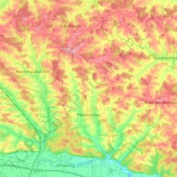
Nom : Carte topographique Pleiskirchen, altitude, relief.
Lieu : Pleiskirchen, Landkreis Altötting, Bayern, 84568, Deutschland (48.28211 12.55354 48.35843 12.70233)
Altitude moyenne : 455 m
Altitude minimum : 380 m
Altitude maximum : 522 m
Autres cartes topographiques
Cliquez sur une carte pour visualiser sa topographie, son altitude et son relief.
Tüßling
Deutschland > Bayern > Landkreis Altötting
Tüßling, Landkreis Altötting, Bayern, 84577, Deutschland
Altitude moyenne : 426 m