
Carte topographique Tweedshaws
Carte interactive
Cliquez sur la carte pour afficher l’altitude.
À propos de cette carte
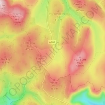
Nom : Carte topographique Tweedshaws, altitude, relief.
Altitude moyenne : 406 m
Altitude minimum : 218 m
Altitude maximum : 538 m
Autres cartes topographiques
Cliquez sur une carte pour visualiser sa topographie, son altitude et son relief.
Madrisa
Verenigd Koninkrijk > Schotland > Scottish Borders > Madrisa
Madrisa, Scottish Borders, Schotland, EH46 7BD, Verenigd Koninkrijk
Altitude moyenne : 295 m