
Carte topographique Railway Station
Carte interactive
Cliquez sur la carte pour afficher l’altitude.
À propos de cette carte
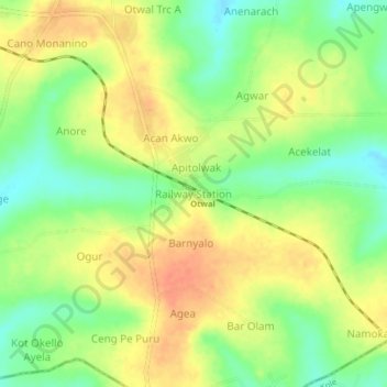
Nom : Carte topographique Railway Station, altitude, relief.
Lieu : Railway Station, Oyam, Northern Region, Uganda (2.47313 32.69783 2.51313 32.73783)
Altitude moyenne : 1 108 m
Altitude minimum : 1 084 m
Altitude maximum : 1 128 m
Autres cartes topographiques
Cliquez sur une carte pour visualiser sa topographie, son altitude et son relief.