
Carte topographique Greenhills
Carte interactive
Cliquez sur la carte pour afficher l’altitude.
Greenhills
Greenhills and the adjacent West Crame are the only barangays in San Juan that are not entirely situated on tuff and tuffaceous sedimentary rock, with parts of the barangay being situated on top of pyroclastic flow adobe deposits. The highest elevation of San Juan can be found in Greenhills at its border with Quezon City's Barangay Camp Aguinaldo along EDSA, peaking at 34 meters (112 ft) above sea level.
À propos de cette carte
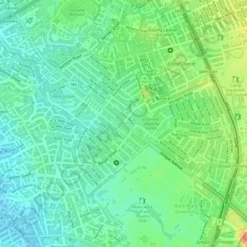
Nom : Carte topographique Greenhills, altitude, relief.
Altitude moyenne : 32 m
Altitude minimum : 8 m
Altitude maximum : 77 m