
Carte topographique Żory
Carte interactive
Cliquez sur la carte pour afficher l’altitude.
À propos de cette carte
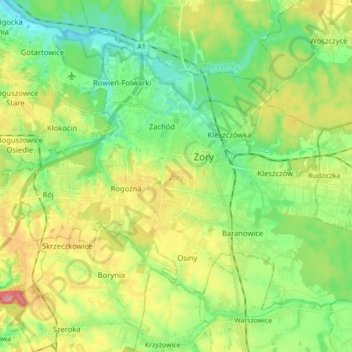
Nom : Carte topographique Żory, altitude, relief.
Lieu : Żory, Silesian Voivodeship, Poland (49.99629 18.60055 50.08160 18.77625)
Altitude moyenne : 263 m
Altitude minimum : 227 m
Altitude maximum : 324 m
The meaning of the town's name is not clear and there are two theories about it. The first one derives it from Old Polish, from annealing, burning of forests, which was the first stage of establishing a permanent settlement in a given place. This version is related to the primitive economy of burning, which was an element of deforestation of the area for settlement. The topographic description of Upper Silesia from 1865, in turn, derives it from the Polish name of the crane bird (Polish: żuraw). It notes the following passage: "In den verscheidenen Urkunden wird Sohrau einmal Żoraw, dann Żora und auch Sora genannt. Der Name ist polnischen Ursprungs.", that is, in English, "In various documents notated as Żoraw, later Żora, and even Sora. The name is of Polish origin."