
Carte topographique Wassaw National Wildlife Refuge
Carte interactive
Cliquez sur la carte pour afficher l’altitude.
À propos de cette carte
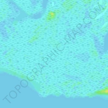
Nom : Carte topographique Wassaw National Wildlife Refuge, altitude, relief.
Altitude moyenne : 2 m
Altitude minimum : -2 m
Altitude maximum : 16 m
Autres cartes topographiques
Cliquez sur une carte pour visualiser sa topographie, son altitude et son relief.
Lake Hartwell
Lake Hartwell, Cooper Valley Road, Fairview, Stephens County, Georgia, USA
Altitude moyenne : 268 m
Eagle Court
USA > Georgia > Eagle Court
Eagle Court, Bulloch County, Georgia, 30460, USA
Altitude moyenne : 62 m
Radium Springs
USA > Georgia > Radium Springs
Radium Springs, Dougherty County, Georgia, 31705, USA
Altitude moyenne : 57 m
Winona Park
USA > Georgia > Winona Park
Winona Park, Ware County, Georgia, 31503, USA
Altitude moyenne : 43 m
Cameron Point
USA > Georgia > Cameron Point
Cameron Point, Hall County, Georgia, 30506:30534, USA
Altitude moyenne : 339 m
Pye Lake
USA > Georgia > Fayetteville
Pye Lake, Cornwallis Way, Sharon Heights, Cottonwood, Fayetteville, Fayette County, Georgia, 30214, USA
Altitude moyenne : 265 m
Blackrock Mountain
Blackrock Mountain, Rabun County, Georgia, 30525, USA
Altitude moyenne : 892 m
Lawson Creek
Lawson Creek, Banks County, Georgia, 30511:30521, USA
Altitude moyenne : 253 m
Arabia Mountain
USA > Georgia > Stonecrest
Arabia Mountain, Stonecrest, DeKalb County, Georgia, 30058-8829, USA
Altitude moyenne : 255 m
Lake Burton
Lake Burton, Moccasin Creek Road, Rabun County, Georgia, USA
Altitude moyenne : 662 m
Winslow Creek
Winslow Creek, Meriwether County, Georgia, 30222, USA
Altitude moyenne : 262 m
Russ Pond
USA > Georgia > Cusseta-Chattahoochee County
Russ Pond, Sigerfoos Road, Cusseta-Chattahoochee County, Chattahoochee County, Georgia, 31905, USA
Altitude moyenne : 89 m
Burnside River
Burnside River, Chatham County, Georgia, 31411, USA
Altitude moyenne : 3 m
Margery Lake
Margery Lake, orange mark trail, Jasper County, Georgia, 30055, USA
Altitude moyenne : 202 m
Hartman Lake
USA > Georgia > Garden Valley
Hartman Lake, GA 127, Garden Valley, Macon County, Georgia, 31081, USA
Altitude moyenne : 127 m
Tates Creek
Tates Creek, Banks County, Georgia, 30511:30521, USA
Altitude moyenne : 259 m
Ferrell Crossroads
USA > Georgia > Ferrell Crossroads
Ferrell Crossroads, Early County, Georgia, USA
Altitude moyenne : 94 m