
Carte topographique Tirich Mir
Carte interactive
Cliquez sur la carte pour afficher l’altitude.
À propos de cette carte
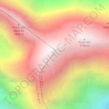
Nom : Carte topographique Tirich Mir, altitude, relief.
Lieu : Tirich Mir, Chitrāl District, Khyber Pakhtunkhwa, Pakistan (36.25404 71.84122 36.25414 71.84132)
Altitude moyenne : 6 886 m
Altitude minimum : 5 538 m
Altitude maximum : 7 666 m
Autres cartes topographiques
Cliquez sur une carte pour visualiser sa topographie, son altitude et son relief.
Chitral
Pakistan > Khyber Pakhtunkhwa > Lower Chitral District > Chitral
Chitral, Lower Chitral District, Khyber Pakhtunkhwa, 7200, Pakistan
Altitude moyenne : 2 982 m
Saraghrar I
Saraghrar I, Chitrāl District, Khyber Pakhtunkhwa, Pakistan
Altitude moyenne : 6 780 m