
Carte topographique دهستان مزرعه شمالی
Carte interactive
Cliquez sur la carte pour afficher l’altitude.
À propos de cette carte
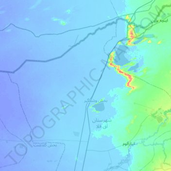
Nom : Carte topographique دهستان مزرعه شمالی, altitude, relief.
Altitude moyenne : -6 m
Altitude minimum : -23 m
Altitude maximum : 43 m
Autres cartes topographiques
Cliquez sur une carte pour visualiser sa topographie, son altitude et son relief.
Fort, Great Wall of Gorgan
Iran > Golestan Province > Aqqala County > دهستان مزرعه شمالی
Altitude moyenne : 3 m