
Carte topographique Puurs
Carte interactive
Cliquez sur la carte pour afficher l’altitude.
À propos de cette carte
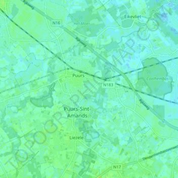
Nom : Carte topographique Puurs, altitude, relief.
Altitude moyenne : 4 m
Altitude minimum : -1 m
Altitude maximum : 9 m
Puurs sits about 5 meters above mean sea level. Its geography shows only minor elevation differences. Puurs is mainly rural, with some low intensity industry development in the North alongside the N16 expressway. However, because of its proximity to the cities of Antwerp and Brussels (both within a 25 km (16 mi) radius) and its excellent accessibility, Puurs is developing increasingly into a residential town.