
Carte topographique Unterreitzing
Carte interactive
Cliquez sur la carte pour afficher l’altitude.
À propos de cette carte
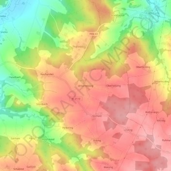
Nom : Carte topographique Unterreitzing, altitude, relief.
Altitude moyenne : 465 m
Altitude minimum : 376 m
Altitude maximum : 525 m
Autres cartes topographiques
Cliquez sur une carte pour visualiser sa topographie, son altitude et son relief.
84371
Deutschland > Bayern > Landkreis Rottal-Inn > Triftern
84371, Triftern, Landkreis Rottal-Inn, Bayern, Deutschland
Altitude moyenne : 425 m