
Carte topographique Eagle Rock Overlook
Carte interactive
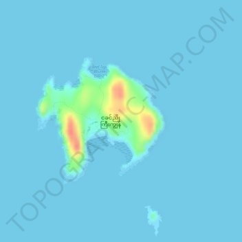
Cliquez sur la carte pour afficher l’altitude.
À propos de cette carte
Nom : Carte topographique Eagle Rock Overlook, altitude, relief.
Altitude moyenne : 3 m
Altitude minimum : -1 m
Altitude maximum : 54 m
Autres cartes topographiques
Cliquez sur une carte pour visualiser sa topographie, son altitude et son relief.
Kawthaung
Myanmar > Tanintharyi Region > Kawthoung Township
Kawthaung, Kawthoung Township, Kawthoung District, Tanintharyi Region, 14091, Myanmar
Altitude moyenne : 18 m