
Carte topographique Aketajawe Lolobata National Park
Carte interactive
Cliquez sur la carte pour afficher l’altitude.
À propos de cette carte
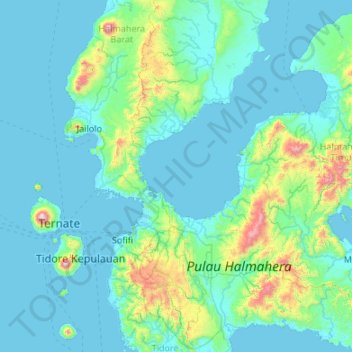
Nom : Carte topographique Aketajawe Lolobata National Park, altitude, relief.
Altitude moyenne : 161 m
Altitude minimum : 0 m
Altitude maximum : 1 688 m
Threats to the national park are posed by illegal logging and mining. Between 1990 and 2003 forests declined in North Maluku from 86% to just under 70%, with much of it occurring in the lowlands (below 400m). As a result, species with large amounts of their range at low elevations were most strongly affected.