
Carte topographique Cabudare
Carte interactive
Cliquez sur la carte pour afficher l’altitude.
À propos de cette carte
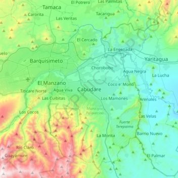
Nom : Carte topographique Cabudare, altitude, relief.
Altitude moyenne : 637 m
Altitude minimum : 282 m
Altitude maximum : 1 730 m
Cabudare (Spanish pronunciation: , original indigenous name Kabudari), is a city in Lara State, in Venezuela, and capital of the Palavecino Municipality. Located at an elevation of 400 m on the Turbio River, it is on the major west-central freeway, the Autopista Centro Occidental. Due to the growth of the economy in Barquisimeto, Cabudare has become a bedroom community, with new housing construction replacing the sugar cane fields. A minority of the population are still engaged in agriculture within the municipality.