Géolocaliser

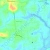
Carte topographique Karikulam

Cliquez sur la carte pour afficher l’altitude.

À propos de cette carte

Nom : Carte topographique Karikulam, altitude, relief.

Lieu : Karikulam, Chalakkudy, Thrissur, Kerala, India (10.40044 76.36670 10.44044 76.40670)

Altitude moyenne : 45 m

Altitude minimum : 10 m

Altitude maximum : 188 m

Autres cartes topographiques

Cliquez sur une carte pour visualiser sa topographie, son altitude et son relief.
Kuzhur

India > Kerala > Chalakkudy > Valiyaparambu

Altitude moyenne : 7 m

Kakkulissery

India > Kerala > Chalakkudy > Valiyaparambu

Altitude moyenne : 10 m

Thiruthiparambu East

India > Kerala > Chalakkudy > Chalakudy

Altitude moyenne : 10 m

Athirappilly

India > Kerala > Chalakkudy

Altitude moyenne : 406 m

Kadukutty

India > Kerala > Chalakkudy > Sampaloor

Altitude moyenne : 8 m

Nandipulam

India > Kerala > Chalakkudy

Altitude moyenne : 16 m

St James Hospital

India > Kerala > Chalakkudy > Chalakudy

Altitude moyenne : 14 m

Lower Sholayar Dam

India > Kerala > Chalakkudy

Altitude moyenne : 773 m

Chalakudy River

India > Kerala > Chalakkudy > Kizhake Chalakudi

Altitude moyenne : 13 m

Mattathur

India > Kerala > Chalakkudy > Kodaly

Altitude moyenne : 199 m

St James Hospital

India > Kerala > Chalakkudy > Chalakudy

Altitude moyenne : 14 m

Équipez-vous pour votre prochaine aventure :

🥤Sac d'Hydratation Trail - Système de boisson intégré pour un accès rapide sans s'arrêter
🩹Pansements pour Ampoules - Soulagement immédiat et cicatrisation rapide
🧥Veste Coupe-Vent - Couche légère et compacte pour se protéger du vent en altitude
🦯Bâtons de randonnée - Bâtons télescopiques pour stabilité et réduction de l’effort
🧢Casquette avec Protège-Nuque - Protection solaire optimale pour les terrains découverts

En tant que Partenaire Amazon, ce site perçoit une commission sur les achats éligibles sans surcoût pour vous.