
Carte topographique Kavali
Carte interactive
Cliquez sur la carte pour afficher l’altitude.
À propos de cette carte
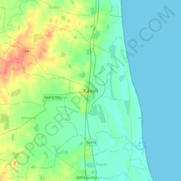
Nom : Carte topographique Kavali, altitude, relief.
Altitude moyenne : 15 m
Altitude minimum : 0 m
Altitude maximum : 72 m
Kavali is located at 14°54′47″N 79°59′35″E / 14.913001°N 79.992921°E / 14.913001; 79.992921. It has an average elevation of 17 metres (56 ft). The town is at a distance of 8 km from the Bay of Bengal.