
Carte topographique Hoogstede
Carte interactive
Cliquez sur la carte pour afficher l’altitude.
À propos de cette carte
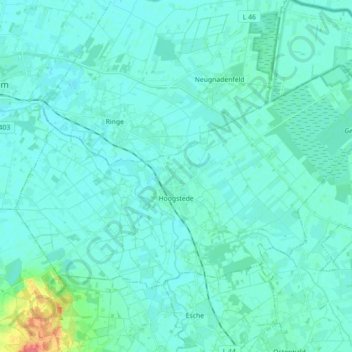
Nom : Carte topographique Hoogstede, altitude, relief.
Altitude moyenne : 18 m
Altitude minimum : 11 m
Altitude maximum : 66 m
Autres cartes topographiques
Cliquez sur une carte pour visualiser sa topographie, son altitude et son relief.
49849
Germany > Lower Saxony > Landkreis Grafschaft Bentheim > Wilsum
49849, Wilsum, Samtgemeinde Uelsen, Landkreis Grafschaft Bentheim, Lower Saxony, Germany
Altitude moyenne : 25 m
Bad Bentheim
Germany > Lower Saxony > Landkreis Grafschaft Bentheim
Bad Bentheim, Landkreis Grafschaft Bentheim, Lower Saxony, 48455, Germany
Altitude moyenne : 38 m