
Carte topographique دهستان بازفت بالا
Carte interactive
Cliquez sur la carte pour afficher l’altitude.
À propos de cette carte
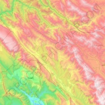
Nom : Carte topographique دهستان بازفت بالا, altitude, relief.
Altitude moyenne : 2 250 m
Altitude minimum : 507 m
Altitude maximum : 4 153 m
Autres cartes topographiques
Cliquez sur une carte pour visualiser sa topographie, son altitude et son relief.
Bazoft
Iran > Chaharmahal and Bakhtiyari Province > Kuhrang County
Bazoft, بخش بازفت, Kuhrang County, Chaharmahal and Bakhtiyari Province, 88691-80537, Iran
Altitude moyenne : 1 569 m