
Carte topographique واما ولسوالۍ
Carte interactive
Cliquez sur la carte pour afficher l’altitude.
À propos de cette carte
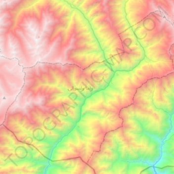
Nom : Carte topographique واما ولسوالۍ, altitude, relief.
Lieu : واما ولسوالۍ, Nouristan, Afghanistan (35.08897 70.65641 35.29411 70.94182)
Altitude moyenne : 3 046 m
Altitude minimum : 1 311 m
Altitude maximum : 4 641 m
Autres cartes topographiques
Cliquez sur une carte pour visualiser sa topographie, son altitude et son relief.
برگ متال
برگ متال, Barg-i Matal, Nouristan, Afghanistan
Altitude moyenne : 3 688 m
Parun
Afghanistan > Nouristan > پارون ولسوالۍ > Parun
Parun, پارون ولسوالۍ, Nouristan, Afghanistan
Altitude moyenne : 3 556 m