
Carte topographique Wermsdorf
Carte interactive
Cliquez sur la carte pour afficher l’altitude.
Wermsdorf
There are numerous cycling routes of low elevation and trail-ways suitable for walking scattered throughout the nearby Wermsdorf Woods. The nearby lakes are available for bathing, boating and fresh water fishing. Wermsdorf also has a number of hostelries for the enjoyment of traditional German food and drink.
À propos de cette carte
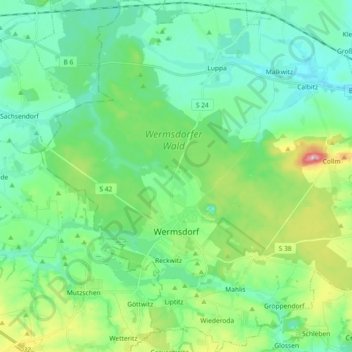
Nom : Carte topographique Wermsdorf, altitude, relief.
Lieu : Wermsdorf, Nordsachsen, Saxony, 04779, Germany (51.24084 12.86866 51.35502 13.04971)
Altitude moyenne : 176 m
Altitude minimum : 131 m
Altitude maximum : 313 m