
Carte topographique Třebíč
Carte interactive
Cliquez sur la carte pour afficher l’altitude.
Třebíč
Třebíč is situated 35 kilometres (22 mi) southeast of Jihlava and 65 kilometres (40 mi) west of Brno. It lies in the Jevišovice Uplands within the Bohemian-Moravian Highlands. The town is located the Jihlava River. The highest point in the municipal territory has an elevation of 579 metres (1,900 ft) above sea level.
À propos de cette carte
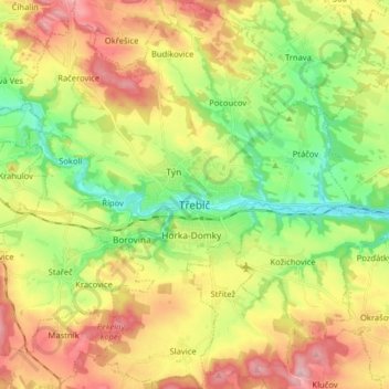
Nom : Carte topographique Třebíč, altitude, relief.
Altitude moyenne : 479 m
Altitude minimum : 386 m
Altitude maximum : 596 m
Autres cartes topographiques
Cliquez sur une carte pour visualiser sa topographie, son altitude et son relief.