
Carte topographique Lajatico
Carte interactive
Cliquez sur la carte pour afficher l’altitude.
Lajatico
Lajatico is a comune (municipality) in the Province of Pisa in the Italian region Tuscany, located about 50 kilometers (31 mi) southwest of Florence and about 40 kilometers (25 mi) southeast of Pisa. Lajatico sits in mainly hilly terrain at variable elevations from 100 to 650 meters (330 to 2,130 ft) above sea level) and dominates both the end of the Valdera valley and the opening of the valley known as Val di Cecina.
À propos de cette carte
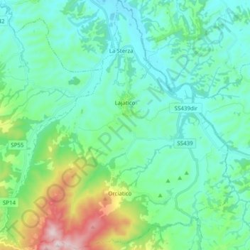
Nom : Carte topographique Lajatico, altitude, relief.
Lieu : Lajatico, Pisa, Tuscany, Italy (43.40992 10.65520 43.52070 10.79411)
Altitude moyenne : 167 m
Altitude minimum : 46 m
Altitude maximum : 642 m