
Carte topographique Port Townsend
Carte interactive
Cliquez sur la carte pour afficher l’altitude.
À propos de cette carte
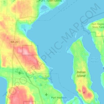
Nom : Carte topographique Port Townsend, altitude, relief.
Lieu : Port Townsend, Jefferson County, Washington, United States (48.02610 -122.79604 48.11819 -122.69386)
Altitude moyenne : 31 m
Altitude minimum : -4 m
Altitude maximum : 126 m
Autres cartes topographiques
Cliquez sur une carte pour visualiser sa topographie, son altitude et son relief.
Port Townsend
United States > Washington > Jefferson County > Port Townsend > Port Townsend
Port Townsend, Jefferson County, Washington, United States
Altitude moyenne : 18 m