
Carte topographique Jinsha
Carte interactive
Cliquez sur la carte pour afficher l’altitude.
À propos de cette carte
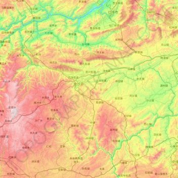
Nom : Carte topographique Jinsha, altitude, relief.
Lieu : Jinsha, Bijie, Guizhou, China (27.11730 105.79177 27.75435 106.72327)
Altitude moyenne : 1 146 m
Altitude minimum : 419 m
Altitude maximum : 2 099 m
Autres cartes topographiques
Cliquez sur une carte pour visualiser sa topographie, son altitude et son relief.