
Carte topographique Hines
Carte interactive
Cliquez sur la carte pour afficher l’altitude.
À propos de cette carte
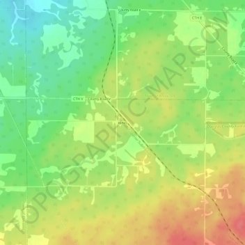
Nom : Carte topographique Hines, altitude, relief.
Altitude moyenne : 333 m
Altitude minimum : 300 m
Altitude maximum : 367 m
Autres cartes topographiques
Cliquez sur une carte pour visualiser sa topographie, son altitude et son relief.
Blueberry
United States > Wisconsin > Douglas County > Town of Maple
Blueberry, Town of Maple, Douglas County, Wisconsin, United States
Altitude moyenne : 349 m
South Range
United States > Wisconsin > Douglas County
South Range, Town of Parkland, Douglas County, Wisconsin, United States
Altitude moyenne : 237 m
City of Superior
United States > Wisconsin > Douglas County > City of Superior
City of Superior, Douglas County, Wisconsin, 54880, United States
Altitude moyenne : 220 m