
Carte topographique Kiełczew
Carte interactive
Cliquez sur la carte pour afficher l’altitude.
À propos de cette carte
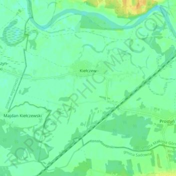
Nom : Carte topographique Kiełczew, altitude, relief.
Altitude moyenne : 99 m
Altitude minimum : 90 m
Altitude maximum : 117 m
Autres cartes topographiques
Cliquez sur une carte pour visualiser sa topographie, son altitude et son relief.
Ostrów Mazowiecka
Poland > Masovian Voivodeship > Ostrów Mazowiecka County
Ostrów Mazowiecka, Ostrów Mazowiecka County, Masovian Voivodeship, 07-300, Poland
Altitude moyenne : 129 m
Małkinia Górna
Poland > Masovian Voivodeship > Ostrów Mazowiecka County
Małkinia Górna, gmina Małkinia Górna, Ostrów Mazowiecka County, Masovian Voivodeship, Poland
Altitude moyenne : 104 m