
Carte topographique Penang Hill
Carte interactive
Cliquez sur la carte pour afficher l’altitude.
À propos de cette carte
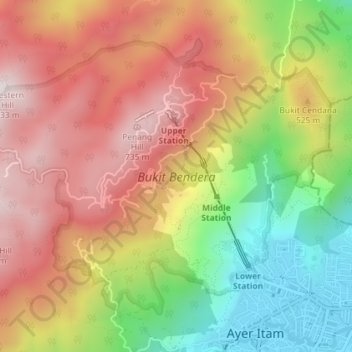
Nom : Carte topographique Penang Hill, altitude, relief.
Altitude moyenne : 436 m
Altitude minimum : 16 m
Altitude maximum : 804 m
A number of hills are covered by Penang Hill, with the highest point being Western Hill that stands at an altitude of 833 meters (2,733 feet) above sea level. Penang Hill is a hilly and forested area that stands out from the lowlands of Malaysia by being hilly and wooded. The area was used as a retreat during the British colonial period, and is now a very popular tourist destination due to its history and heritage.