
Carte topographique Riverpoint
Carte interactive
Cliquez sur la carte pour afficher l’altitude.
À propos de cette carte
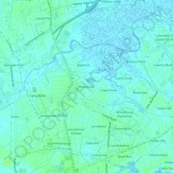
Nom : Carte topographique Riverpoint, altitude, relief.
Altitude moyenne : 4 m
Altitude minimum : -2 m
Altitude maximum : 12 m
Autres cartes topographiques
Cliquez sur une carte pour visualiser sa topographie, son altitude et son relief.
Marlborough
United States > South Carolina > Charleston County > Charleston
Marlborough, Charleston, Charleston County, South Carolina, 29422, United States
Altitude moyenne : 4 m
Sherwood Forest
United States > South Carolina > Charleston County > Charleston
Sherwood Forest, Charleston, Charleston County, South Carolina, 29407, United States
Altitude moyenne : 5 m
Gadsden Green Homes
United States > South Carolina > Charleston County > Charleston > Gadsden Green Homes
Gadsden Green Homes, Charleston, Charleston County, South Carolina, 29425, United States
Altitude moyenne : 4 m