
Carte topographique Gray
Carte interactive
Cliquez sur la carte pour afficher l’altitude.
À propos de cette carte
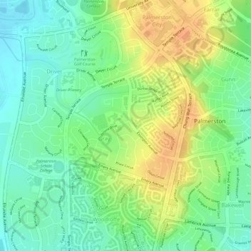
Nom : Carte topographique Gray, altitude, relief.
Altitude moyenne : 31 m
Altitude minimum : 11 m
Altitude maximum : 52 m
Autres cartes topographiques
Cliquez sur une carte pour visualiser sa topographie, son altitude et son relief.
Driver
Australia > City of Palmerston > Palmerston
Driver, Palmerston, City of Palmerston, Northern Territory, 0830, Australia
Altitude moyenne : 25 m
Bakewell
Australia > City of Palmerston > Palmerston
Bakewell, Palmerston, City of Palmerston, Northern Territory, 0830, Australia
Altitude moyenne : 26 m