
Carte topographique Wana
Carte interactive
Cliquez sur la carte pour afficher l’altitude.
À propos de cette carte
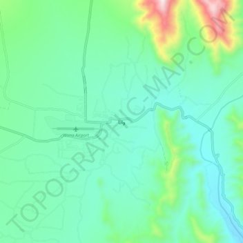
Nom : Carte topographique Wana, altitude, relief.
Altitude moyenne : 1 432 m
Altitude minimum : 1 243 m
Altitude maximum : 2 140 m
Autres cartes topographiques
Cliquez sur une carte pour visualiser sa topographie, son altitude et son relief.
South Wazīristān Agency
Pakistan > Division de Dera Ismail Khan
South Wazīristān Agency, Division de Dera Ismail Khan, Khyber Pakhtunkhwa, Pakistan
Altitude moyenne : 1 371 m