Géolocaliser

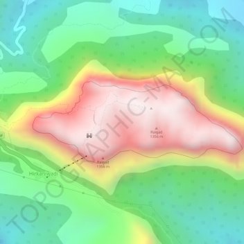
Carte topographique Raigad Fort

Cliquez sur la carte pour afficher l’altitude.

Raigad Fort

Located at an elevation of 820 metres (2,700 ft)above sea level in the Sahyadri mountain range, the fort offers panoramic views of the surrounding region. The fort was home to around 1,550 residents, with an average family size of five. Access to the fort requires ascending approximately 1,737 steps. Alternatively, visitors can use the Raigad Ropeway, an aerial tramway spanning 750 m (2,460 ft) in length and reaching a height of 400 m (1,300 ft), which transports passengers to the fort in approximately four minutes.

Wikipedia (CC-BY-SA 3.0)

À propos de cette carte

Nom : Carte topographique Raigad Fort, altitude, relief.

Lieu : Raigad Fort, Lingana to Raigad, Vagheri, Chatri Nizampur, Vagheri, Mahad Taluka, Raigad, Maharashtra, 402305, India (18.23072 73.43435 18.24092 73.45876)

Altitude moyenne : 448 m

Altitude minimum : 119 m

Altitude maximum : 866 m

Équipez-vous pour votre prochaine aventure :

📍Balise de Détresse Satellite - Sécurité ultime pour les zones sans réseau mobile
⌚Montre Altimètre Baromètre - Capteurs ABC pour suivre l'élévation et la météo en temps réel
🪙Couverture de Survie - Protection thermique d'urgence indispensable
🧦Chaussettes Anti-Ampoules - Confort thermique et protection pour les longues marches
🔦Lampe de Poche à Zoom - Faisceau ajustable pour voir au loin ou éclairer large

En tant que Partenaire Amazon, ce site perçoit une commission sur les achats éligibles sans surcoût pour vous.