
Carte topographique Kirchroth
Carte interactive
Cliquez sur la carte pour afficher l’altitude.
À propos de cette carte
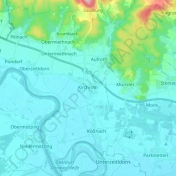
Nom : Carte topographique Kirchroth, altitude, relief.
Altitude moyenne : 343 m
Altitude minimum : 314 m
Altitude maximum : 551 m
Autres cartes topographiques
Cliquez sur une carte pour visualiser sa topographie, son altitude et son relief.
Konzell
Deutschland > Bayern > Landkreis Straubing-Bogen > Konzell
Konzell, Landkreis Straubing-Bogen, Bayern, 94357, Deutschland
Altitude moyenne : 541 m