
Carte topographique Río Seco Bajo
Carte interactive
Cliquez sur la carte pour afficher l’altitude.
À propos de cette carte
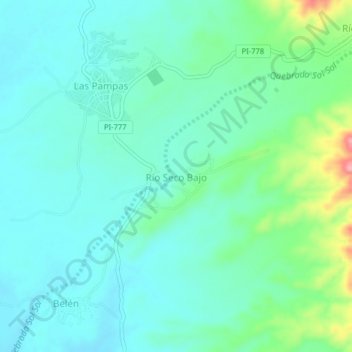
Nom : Carte topographique Río Seco Bajo, altitude, relief.
Lieu : Río Seco Bajo, Chulucanas, Morropón, Piura, Perú (-5.03574 -80.16893 -4.99574 -80.12893)
Altitude moyenne : 117 m
Altitude minimum : 89 m
Altitude maximum : 215 m
Autres cartes topographiques
Cliquez sur une carte pour visualiser sa topographie, son altitude et son relief.
Km. 50
Perú > Piura > Chulucanas > Km. 50
Km. 50, Chulucanas, Morropón, Piura, Perú
Altitude moyenne : 119 m
Plaza de Armas
Perú > Piura > Chulucanas
Plaza de Armas, Chulucanas, Morropón, Piura, Perú
Altitude moyenne : 94 m