
Carte topographique Linglestown
Carte interactive
Cliquez sur la carte pour afficher l’altitude.
Linglestown
The highest elevation is 995 feet (303 m) on the south slope of Blue Mountain, along Blue Mountain Parkway north of the center of town. Pennsylvania Route 39 (Linglestown Road) passes east-to-west through the village, leading east 3.5 miles (5.6 km) to Exit 77 on Interstate 81 and west 5 miles (8 km) to Highway 22-322 at the north end of Harrisburg.
À propos de cette carte
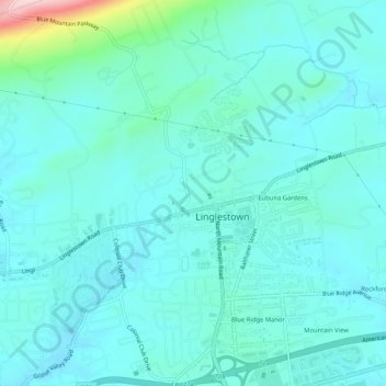
Nom : Carte topographique Linglestown, altitude, relief.
Altitude moyenne : 161 m
Altitude minimum : 124 m
Altitude maximum : 376 m