
Carte topographique Jasper
Carte interactive
Cliquez sur la carte pour afficher l’altitude.
Jasper
Jasper was founded in 1853 as seat of the newly formed Pickens County. It was incorporated in 1857 as a town and in 1957 as a city. The community is named for William Jasper, a hero of the American Revolutionary War. Jasper is situated at an elevation of 1,463 feet (446 m).
À propos de cette carte
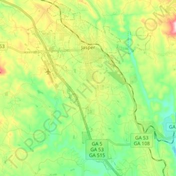
Nom : Carte topographique Jasper, altitude, relief.
Lieu : Jasper, Pickens County, Georgia, 30142, United States (34.39175 -84.47465 34.49531 -84.38435)
Altitude moyenne : 408 m
Altitude minimum : 278 m
Altitude maximum : 646 m
Autres cartes topographiques
Cliquez sur une carte pour visualiser sa topographie, son altitude et son relief.