
Carte topographique النصر
Carte interactive
Cliquez sur la carte pour afficher l’altitude.
À propos de cette carte
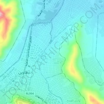
Nom : Carte topographique النصر, altitude, relief.
Altitude moyenne : 252 m
Altitude minimum : 218 m
Altitude maximum : 416 m
Autres cartes topographiques
Cliquez sur une carte pour visualiser sa topographie, son altitude et son relief.
رمادة
Túnez > Gobernación de Tataouine > رمادة الشرقية
رمادة, رمادة الشرقية, معتمدية رمادة, Gobernación de Tataouine, 3240, Túnez
Altitude moyenne : 295 m