
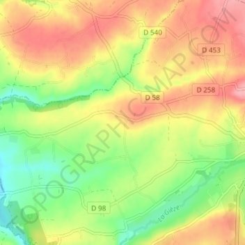
Carte topographique La Croix des Tondieres
Carte interactive
Cliquez sur la carte pour afficher l’altitude.
À propos de cette carte
Nom : Carte topographique La Croix des Tondieres, altitude, relief.
Altitude moyenne : 121 m
Altitude minimum : 66 m
Altitude maximum : 173 m
Autres cartes topographiques
Cliquez sur une carte pour visualiser sa topographie, son altitude et son relief.
La Goupillière
France > Normandie > Manche > Percy-en-Normandie > Percy
La Goupillière, Percy, Percy-en-Normandie, Saint-Lô, Manche, Normandie, France métropolitaine, 50410, France
Altitude moyenne : 106 m
Le Moulin de Haut
France > Normandie > Manche > Percy-en-Normandie > Percy
Le Moulin de Haut, Percy, Percy-en-Normandie, Saint-Lô, Manche, Normandie, France métropolitaine, 50410, France
Altitude moyenne : 139 m