
Carte topographique Loughgall
Carte interactive
Cliquez sur la carte pour afficher l’altitude.
À propos de cette carte
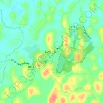
Nom : Carte topographique Loughgall, altitude, relief.
Altitude moyenne : 32 m
Altitude minimum : 12 m
Altitude maximum : 74 m
Autres cartes topographiques
Cliquez sur une carte pour visualiser sa topographie, son altitude et son relief.
Portadown
United Kingdom > Northern Ireland > County Armagh
Portadown, County Armagh, Ulster, Northern Ireland, BT62 1BF, United Kingdom
Altitude moyenne : 28 m
Armagh
United Kingdom > Northern Ireland > County Armagh > Armagh
Armagh, County Armagh, Ulster, Northern Ireland, United Kingdom
Altitude moyenne : 100 m
Lurgan
United Kingdom > Northern Ireland > County Armagh > Lurgan
Lurgan, County Armagh, Northern Ireland, United Kingdom
Altitude moyenne : 48 m