
Carte topographique Mount Magazine State Park
Carte interactive
Cliquez sur la carte pour afficher l’altitude.
Mount Magazine State Park
There also exist many opportunities for ATV riding, backpacking, hang gliding, mountain biking, rappelling, and rock climbing within the park. The park hosts the annual Mount Magazine International Butterfly Festival, and is a haven for many rare species of butterflies in Arkansas due to the special blend of altitude and temperature available. The state butterfly, the Diana fritillary, is found almost exclusively in the Arkansas River Valley and the Petit Jean River Valley.
À propos de cette carte
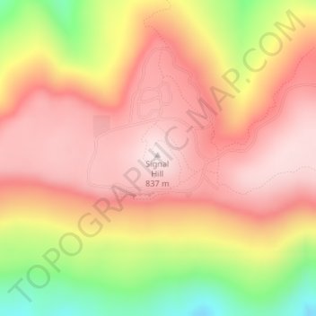
Nom : Carte topographique Mount Magazine State Park, altitude, relief.
Altitude moyenne : 667 m
Altitude minimum : 373 m
Altitude maximum : 839 m
Autres cartes topographiques
Cliquez sur une carte pour visualiser sa topographie, son altitude et son relief.