
Faire un don
Équipez-vous pour votre prochaine aventure :
En tant que Partenaire Amazon, ce site perçoit une commission sur les achats éligibles sans surcoût pour vous.
Carte topographique Waitaki River
Cliquez sur la carte pour afficher l’altitude.
Faire un don
Équipez-vous pour votre prochaine aventure :
En tant que Partenaire Amazon, ce site perçoit une commission sur les achats éligibles sans surcoût pour vous.
À propos de cette carte
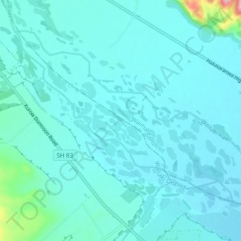
Nom : Carte topographique Waitaki River, altitude, relief.
Lieu : Waitaki River, Waitaki District, Canterbury, New Zealand (-44.82105 170.53809 -44.78567 170.60552)
Altitude moyenne : 178 m
Altitude minimum : 153 m
Altitude maximum : 414 m
Faire un don
Équipez-vous pour votre prochaine aventure :
En tant que Partenaire Amazon, ce site perçoit une commission sur les achats éligibles sans surcoût pour vous.
Autres cartes topographiques
Cliquez sur une carte pour visualiser sa topographie, son altitude et son relief.
Lake Ōhau
New Zealand > Canterbury > Waitaki District
Wilding Pines (Pinus Cortorta, Pinus sylvestris) are problematic on the foreshore of Lake Ōhau. Pinus contorta grow “probably five to 10 times faster” in the Mackenzie Country (and Lake Ōhau) than in their native North America. They can establish themselves at altitudes of up to 2000 metres. Where they…
Altitude moyenne : 904 m
Lindis Pass
New Zealand > Canterbury > Waitaki District
Lindis Pass (Māori: Ōmakō) (elevation 971 m) is located in the South Island of New Zealand. A carpark at the top of the pass provides access to a viewpoint and two short trails to other viewing spots.
Altitude moyenne : 1 011 m