
Carte topographique Waterton Park
Carte interactive
Cliquez sur la carte pour afficher l’altitude.
À propos de cette carte
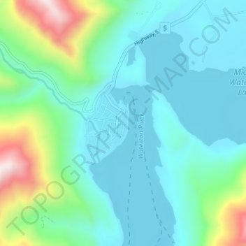
Nom : Carte topographique Waterton Park, altitude, relief.
Altitude moyenne : 1 456 m
Altitude minimum : 1 269 m
Altitude maximum : 2 207 m
It is located at the southwestern terminus of Highway 5, approximately 54 kilometres (34 mi) west of the Town of Cardston and 55 kilometres (34 mi) south of the Town of Pincher Creek. This hamlet is north of Glacier National Park in Montana. It has an elevation of 1,280 metres (4,200 ft).
Autres cartes topographiques
Cliquez sur une carte pour visualiser sa topographie, son altitude et son relief.
Waterton Lakes National Park
Canada > Alberta > Improvement District No. 04
Waterton Lakes National Park, Improvement District No. 04, Alberta, T0K 2M0, Canada
Altitude moyenne : 1 778 m
Mount Blakiston
Canada > Alberta > Improvement District No. 04
Mount Blakiston, Improvement District No. 04, Alberta, Canada
Altitude moyenne : 2 328 m