
Carte topographique Appin
Carte interactive
Cliquez sur la carte pour afficher l’altitude.
À propos de cette carte
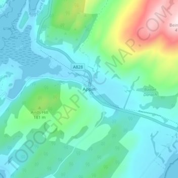
Nom : Carte topographique Appin, altitude, relief.
Lieu : Appin, Argyll and Bute, Scotland, PA38 4DB, United Kingdom (56.54179 -5.37849 56.58179 -5.33849)
Altitude moyenne : 93 m
Altitude minimum : -1 m
Altitude maximum : 461 m
Autres cartes topographiques
Cliquez sur une carte pour visualiser sa topographie, son altitude et son relief.
Staffa
United Kingdom > Scotland > Argyll and Bute
Staffa, Argyll and Bute, Scotland, United Kingdom
Altitude moyenne : 0 m
Garelochhead
United Kingdom > Scotland > Argyll and Bute
Garelochhead, Argyll and Bute, Scotland, G84 0AY, United Kingdom
Altitude moyenne : 110 m
North Connel
United Kingdom > Scotland > Argyll and Bute
North Connel, Argyll and Bute, Scotland, PA37 1PL, United Kingdom
Altitude moyenne : 19 m