
Carte topographique Lakehurst
Carte interactive
Cliquez sur la carte pour afficher l’altitude.
À propos de cette carte
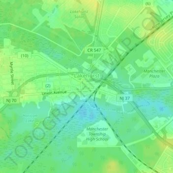
Nom : Carte topographique Lakehurst, altitude, relief.
Altitude moyenne : 21 m
Altitude minimum : 11 m
Altitude maximum : 31 m
The borough's lake, Lake Horicon, existed prior to 1942, as clearly shown in aerial photographs from 1940 and 1931 and topographical maps from 1912. The cedar water lake remains stream-fed.