
Carte topographique Khlong Toei District
Carte interactive
Cliquez sur la carte pour afficher l’altitude.
À propos de cette carte
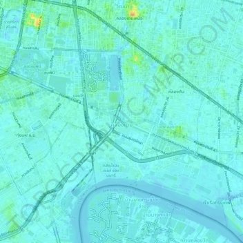
Nom : Carte topographique Khlong Toei District, altitude, relief.
Lieu : Khlong Toei District, Bangkok, Thailand (13.69580 100.55073 13.74284 100.60166)
Altitude moyenne : 7 m
Altitude minimum : -3 m
Altitude maximum : 47 m
Autres cartes topographiques
Cliquez sur une carte pour visualiser sa topographie, son altitude et son relief.