
Carte topographique Kainantu
Carte interactive
Cliquez sur la carte pour afficher l’altitude.
À propos de cette carte
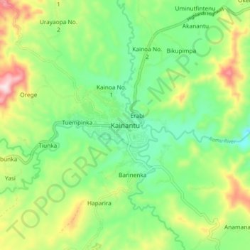
Nom : Carte topographique Kainantu, altitude, relief.
Altitude moyenne : 1 628 m
Altitude minimum : 1 472 m
Altitude maximum : 1 915 m
A narrow south-east-trending dissected plateau dominates area to the south; it forms the watershed between rivers draining north to the Markham-Ramu Graben, and those draining south to the Papuan coast. The plateau ranges in elevation between 7,500 feet (2,300 m) and 8,000 feet (2,400 m) above sea level, and is about 2,500 feet (760 m) above the surrounding country. It is 11 miles (18 km) wide at its north-western end, but narrows to about 3 miles (4.8 km)to the south-east, where Nompia Creek cuts across it in a deep gorge . East of Nompia Creek, it is about 8 miles (13 km) wide, and the Lamari River flows across it in another deep gorge. The streams draining the plateau are mature over most of their courses, but near its edge they are deeply incised and flow along youthful valleys.