
Carte topographique מועצה אזורית מרום הגליל
Carte interactive
Cliquez sur la carte pour afficher l’altitude.
À propos de cette carte
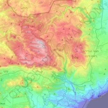
Nom : Carte topographique מועצה אזורית מרום הגליל, altitude, relief.
Lieu : מועצה אזורית מרום הגליל, District nord, 20107, Israël (32.85291 35.34763 33.09314 35.54833)
Altitude moyenne : 448 m
Altitude minimum : -219 m
Altitude maximum : 1 192 m