
Faire un don
Équipez-vous pour votre prochaine aventure :
En tant que Partenaire Amazon, ce site perçoit une commission sur les achats éligibles sans surcoût pour vous.
Carte topographique Populonia
Cliquez sur la carte pour afficher l’altitude.
Faire un don
Équipez-vous pour votre prochaine aventure :
En tant que Partenaire Amazon, ce site perçoit une commission sur les achats éligibles sans surcoût pour vous.
Populonia
In geology, the "Tuscan metallogenic province" derived from volcanic intrusions into southern Etruria due to extension of the crust there (which also created a karst topography in western Italy) from the late Miocene to the Pleistocene. This process emplaced iron oxide deposits on Elba, pyrite in southern Tuscany and various kinds of skarn including copper-bearing in the Colline Metallifere, called Etruria Mineraria in the Middle Ages. The ancient slag-heaps are estimated to weigh 2–4 million tons, representing an annual iron production of between 1,600–2,000 and 10,000 tons, according to varying modern estimates.
Faire un don
Équipez-vous pour votre prochaine aventure :
En tant que Partenaire Amazon, ce site perçoit une commission sur les achats éligibles sans surcoût pour vous.
À propos de cette carte
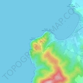
Nom : Carte topographique Populonia, altitude, relief.
Lieu : Populonia, Piombino, Livorno, Tuscany, Italy (42.96945 10.47157 43.00945 10.51157)
Altitude moyenne : 34 m
Altitude minimum : 0 m
Altitude maximum : 265 m
Faire un don
Équipez-vous pour votre prochaine aventure :
En tant que Partenaire Amazon, ce site perçoit une commission sur les achats éligibles sans surcoût pour vous.