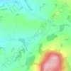
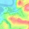
Carte topographique Rathnure
Cliquez sur la carte pour afficher l’altitude.
À propos de cette carte

Nom : Carte topographique Rathnure, altitude, relief.
Altitude moyenne : 118 m
Altitude minimum : 62 m
Altitude maximum : 251 m
Autres cartes topographiques
Cliquez sur une carte pour visualiser sa topographie, son altitude et son relief.
Taghmon
Ireland > County Wexford > New Ross Municipal District
Many Irish place names are topographically descriptive, and 'Achadh Liathdrom' is no exception. From the western side of the Forth Mountain, as it slopes down towards Ballintlea, a succession of gradual hills and valleys undulate their way across this part of County Wexford towards Camross, Bree and…
Altitude moyenne : 67 m